
The Seven Summits of Benton County
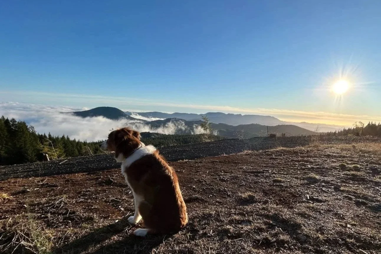
High on a mountain.
There are two types of people: those who make lists, and those who really should add “start making lists” to their list. Checklists, tick-lists, “honey do” lists, the list (how meta) of lists goes on. Lists help us organize our thoughts, set priorities, and enforce accountability in many aspects of our lives. And, for the record, thinking of something you have already done, and then adding it to your list only to immediately cross it off (the sense of accomplishment!) is completely ok. If you are that person, I am here for you.
In outdoor recreation in general and in climbing / mountaineering in particular, list making is an Olympic sport. As examples, Colorado has its “Fourteeners” (peaks with summits in excess of 14,000 feet; there are 58 of them), Washington State has its Bulger List (100 highest peaks in the state), and the Adirondacks have the High Peaks (peaks with summits in excess of 4,000 feet; there are 46 of them). For most outdoor enthusiasts, completing one of these, or some other equivalent list, in their lifetime is a major accomplishment. For others, merely ticking off all of the climbs on one of these lists is kids’ play (we call these people freaks of nature, robots, or Alex Honnold) and they constantly up the ante in absurd ways. Using only bicycles for transportation between peaks, accomplishing the list in an ever-shrinking timeframe, doing all of the climbs in high heels, and so on.
The granddaddy of these lists, perhaps, is the Seven Summits. First accomplished in 1985 by Richard Bass, the general idea is that the Seven Summits consist of the highest peaks on each of the seven continents. And here is where the asterisks, disclaimers, and caveats begin. For if there is anything people like to do more than climbing, it is to argue about climbing. It sounds so simple. The highest peak on each continent. What could go wrong? Well, go ask Pluto. Those of us who grew up in a certain era knew Pluto as the last part of “My Very Eager Mother Just Served Us Nine Pizzas.” But, these days, millennials are just served Noodles, and not Nine Pizzas, while Pluto sulks in the corner with Ceres, Eris, and the other “dwarf planets” in our solar system. Geography can be as confounding as astronomy when it comes to definitions and the Seven Summits list raises questions of how we define the continents, and how we deal with access issues that may preclude being able to visit a particular peak, among others. That all said, the most commonly accepted list of peaks for the Seven Summits includes Mt. Everest (Asia), Aconcagua (South America), Denali (North America), Kilimanjaro (Africa), Mt. Elbrus (Europe), Mt. Vinson (Antarctica), and Puncak Jaya (Oceania). And, since 1985, not only do we have more than 500 people who have ticked all the peaks in this list, we have the youngest to do so, the oldest to do so, the person who climbed all seven in the shortest time period, the first married couple to do so (without getting divorced in the process, we can only hope), and so on. But here’s the thing.
The Seven Summits are hard. And expensive. And, some say, highly problematic on many levels including overcrowding, environmental impacts, and negative commodification of local guides, among others. And here’s the other thing. Adventure is in the eye of the beholder. You don’t need expensive permits, 24 hour flights, and bottled oxygen to have a good time. With a little creativity, a sense of whimsy, and some good maps, you and your friends can set up challenges and adventures in your local environs. This “look local” philosophy is not a new concept. For example, one key aspect of the whole “slow food” movement is to celebrate and support local producers, farmers’ markets, and local cuisines. As another example, over-tourism in many areas (think Venice, Paris, Yellowstone, and more) is contributing to an emerging local tourism movement where people seek out meaning cultural, educational, or recreational experiences closer to home, helping to build community and to support local economies.
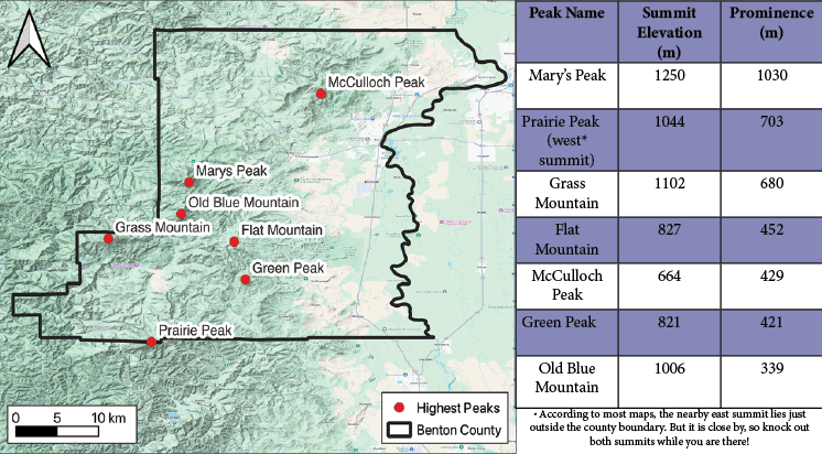
Map of Benton County with the seven highest peaks by prominence. Courtesy of David Hill
With this as an introduction, I give you your winter assignment: the Seven Summits of Benton County. And, before the arguments start, let me explain that peaks or mountains can be classified by summit height, or by what is called prominence. Prominence is the vertical distance between a summit and the surrounding land mass. A minor bump on the ridge of a mountain may stick out from the surrounding area, but do we consider it its own mountain? Usually not, due to a lack of prominence. So, the list below identifies and ranks the top 7 peaks in Benton County, by prominence. And, those checkboxes in the left-most column are not just there by accident, in case you were wondering.
It would take away all of the adventure and fun if I used the rest of this article to give you a blow-by-blow accounting of each peak, along with turn-by-turn driving instructions. However, let me give you a few thoughts and suggestions, in no particular order. First, Mary’s Peak and McCulloch Peak are, in many ways, the low-hanging-fruit of this list of summits. You can drive nearly to the summit of Mary’s, assuming that there is no snow, and many people have probably already been to its summit, given its reputation for wonderful views. McCulloch Peak, known affectionately as Mac Peak by locals, is the high point of the McDonald-Dunn Research Forest, managed by Oregon State University. While you can’t drive up, and you’ll definitely earn the summit (roughly 4 miles and 1800 feet of elevation gain), there are multiple trails and gravel roads that will get you there, most of which are well marked. In addition, there is a very welcome bench at the top where you can rest before the trek back down. So, knock these two off first while you research and strategize the rest.
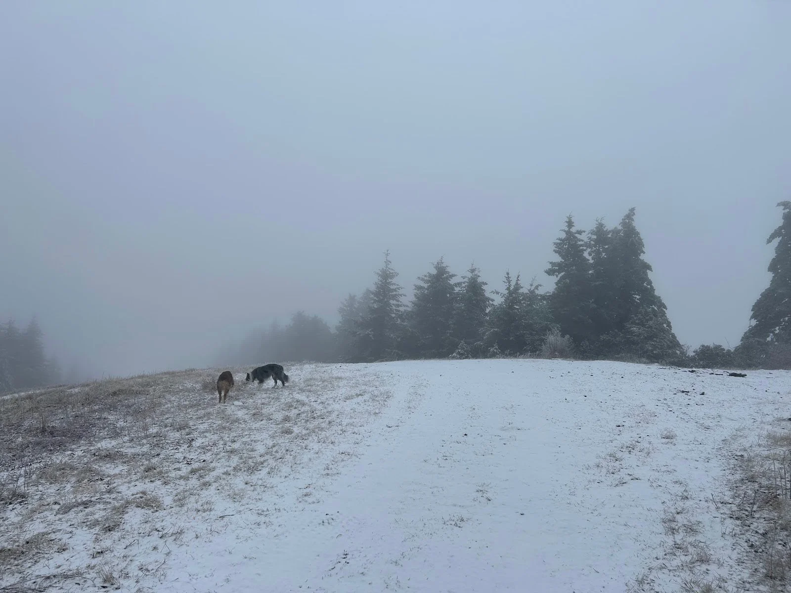
Win some, lose some. A socked-in and very, very soggy day on Prairie Peak.
Second, the remaining five peaks are pretty “out there.” Do not trust Google maps (ask me how I know), and instead consider using the driving instructions that can be found at peakbagger.com as a decent starting point. Your literal and metaphorical mileage may vary, however. Many of the roads you will encounter will be rough. I did them all with our minivan but you should ask my kids about our family adventures before you take that as a “wow no problem, my car can get there then” endorsement. Also, take a jack and know how to change a spare (again, ask me how I know). Consider taking a Garmin Inreach, or some other device that you can use to communicate in an emergency, as the cellular service ranges from bad to worse. The bottom line is that if you have car (or other) problems, it is highly unlikely that anyone will find you for a while, so be proactive and self-reliant. A related note is that, when you venture into the coast range, you will encounter a mixture of land ownership which includes United States Forest Service, Bureau of Land Management, and private. Be sure to research your route and take steps to make sure that if permits or permission are required for the route you choose, you obtain them in advance. Third, there is a lot of interesting history hiding in the coast range. Most of these peaks had fire lookout towers on them at some point, and careful searching at the summits will turn up concrete foundations or other evidence. Some online sleuthing (firetower.org is a good starting point) will lead you towards the back stories of why and when these towers were constructed, often with CCC (Civilian Conservation Corps) labor. While other counties in Oregon have many surviving fire lookouts, including some which function as USFS rentals, it appears that there are no existing lookouts in Benton County, with all being decommissioned in the second half of the 20th century.
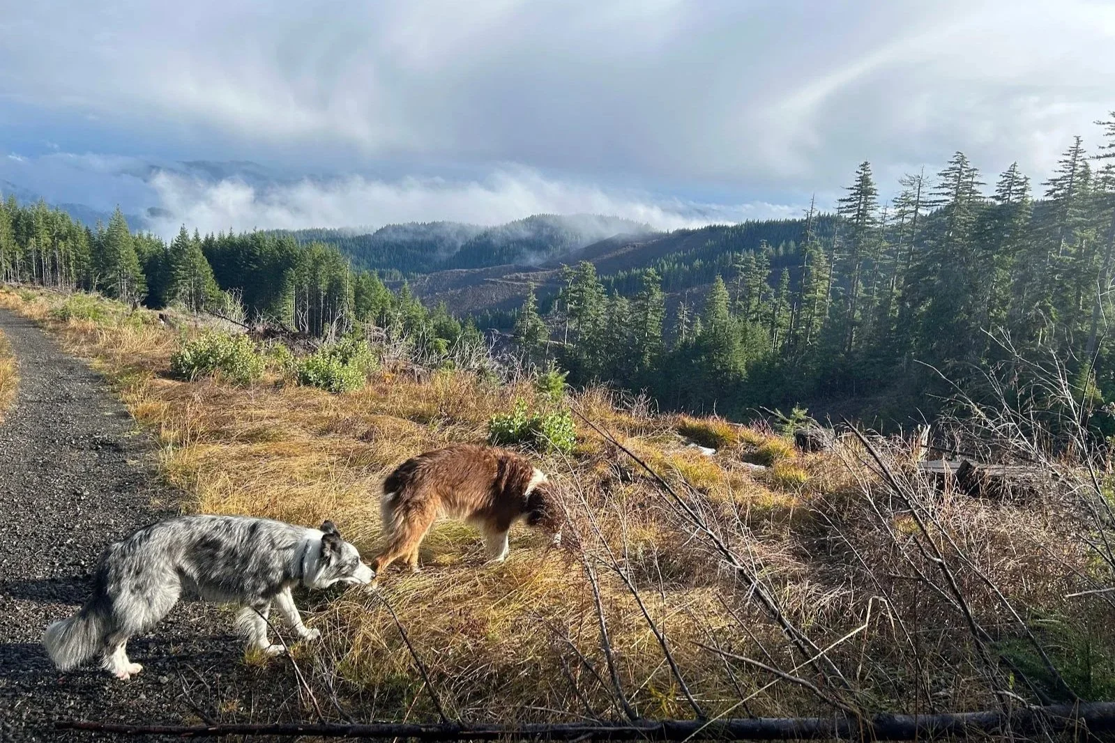
Dogs Ritter and Banner enjoying some late-day sun high on Grass Mountain.
Finally, do I have a favorite? C’mon, that’d be like saying I have a favorite child (kiddo, if you’re reading this, it’s you, but don’t tell your sisters!). I suppose it all depends on what you are looking for. If it’s views, then something like Mary’s, Flat, or Old Blue may be your best bet. If you like long drives deep, deep into the forest, then you’ll love Grass Mountain, Old Blue, and Prairie. If you like logging history, absolutely check out Green Peak since the ‘standard’ approach will take you right through (roll down your window and say hello) the fascinating Hull-Oakes mill. If you want to drive to the absolute top of a peak and you have the car for it, Flat Mountain is for you.
In the end, will people be lining up to tick off the Seven Summits of Benton County? Probably not, and that is ok. One of the great things about making up lists of obscure objectives to pass the time in the rainy season is that the crowds will be elsewhere. I absolutely do look forward to hearing about the first person to hit all seven of these summits in a single day. I thought about it, but then thought better of it. And, I will definitely buy dinner for the first person to hit all seven by bicycle from their house. Finally, while I have focused on Benton County, since I am a Corvallis resident, I’d love to hear about people who identify and then take on the Seven Summits in a different county in Oregon. Adventure is everywhere, have fun finding it. In the meantime here are a few lingering items to check off your list.
Call your parents and say hello
Pet a dog
Pick up trash if you see it
Make someone smile
Go to a museum / musical / concert (pick one)
David Hill has been a resident of the Willamette Valley for 15 years. He is an Oregon State University professor, a National Geographic Explorer, a member of the Science Alliance for Protect our Winters, and a member of Corvallis Mountain Rescue. Whether it is for work, for recreation, or for search and rescue missions, he is enthusiastic about traveling up, down, and around Oregon’s many mountains and hills.